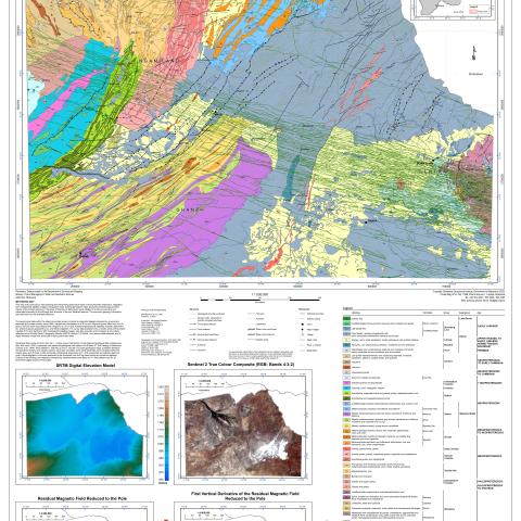
This map was produced by reprocessing and interpreting geophysical data covering Northern Botswana, integrated with multispectral satellite imagery, topographic data, existing geological maps, analyzed borehole logs and field checks of the limited outcrops in the areas of interest. All data layers were collated in a GIS environment and interpreted manually for the lithology and structure of the sub-Kalahari bedrock. The economic geology information
was retrieved from the available literature.
The geophysical data within the sheet comprises dozens of airborne magnetic datasets acquired by government agencies and private industry since 1989, merged and interpolated to a 50 m grid. Regional gravity data from five (5) ground surveys were reprocessed and merged to a 2.5 km grid. Additional geophysical datasets included radiometric (3), airborne gravity gradiometry (3), and electromagnetic (17) survey data available only in certain areas of the project.
Landsat 8 OLI and Sentinel-2 MSI multispectral satellite imagery was also acquired and processed to at-surface reflectance and Shuttle Radar Topography Mission (SRTM) Version 3.0 Global 1 arc-second data obtained, and a digital elevation model was produced covering the project area. Geological data came primarily from the 1:1 million scale 1998 edition of the National Geological Map of Botswana (Key and Ayres, 2000), supported with additional geological information from Bulletin 37 The Geology of Botswana (Carney et al., 1994). More detailed 1:250:000 (2) and 1:125,000 (12) scale geological maps, published literature and academic theses, and industry reports, were also consulted. Over 5,800 boreholes were compiled within the project area, and of those, 2,453 contained a lithological description and 1,378 intersected sub-Kalahari bedrock units. Lithostratigraphic units were assigned to the boreholes from drill log descriptions and locations digitized. Checks of the lithology and magnetic susceptibility measurements were taken at 141 field stations and on 20 boreholes logged as part of the project.


