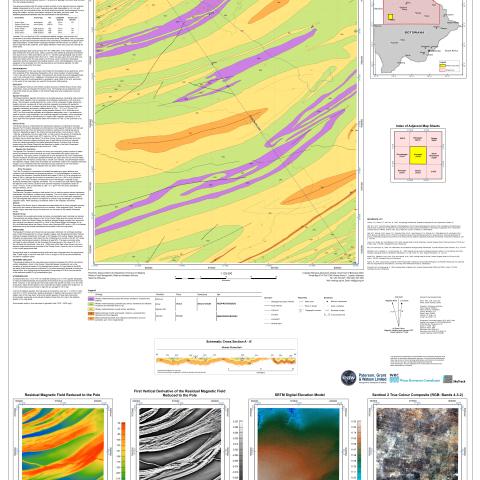
Map sheet 2121B is delimited by latitudes 21°S and 21.5°S, and longitudes 21.5°E and 22°E. The area is very sparsely populated and the village of Qabo is the only population centre. A north-south gravel road connects Qabo to Ghanzi and to Highway A3, and a dirt track connects Q abo to Grootlaagte in the west.The pre-Kalahari bedrock of the sheets consists primarily of folded Ghanzi Group metasedimentary rock s and Kgwebe Formation rock s. The Kalahari Group sediments cover most of the sheet but are absent in the Ghanzi Ridge area where basement rocks are exposed.


