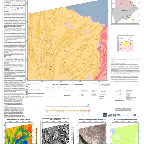
Map sheet 1822 is delimited by latitude 19°S , the Botswana-Namibia border (Caprivi S trip) and longitudes 22°E and 23°E. Numerous villages and settlements lie along the banks of the Okavango swampland, although they become sparse inland north towards the Caprivi. Highway A35 runs through the southwestern corner of the map sheet and parallel to the Okavango River.
The geophysical data within the sheet consists primarily of two regional airborne magnetic datasets merged and interpolated to a 50 m grid. Small high resolution airborne magnetic datasets were also available over discrete magnetic anomalies west of Ikoga. Regional gravity data interpolated to a 2.5 km grid and time-domain electromagnetic data covering the Okavango area were also used.
GEOLOGY
The pre-Kalahari bedrock is interpreted to largely consist of metasedimentary rocks of the Tsodilo Hills Group intruded by unex posed granite bodies in the east. The Kwando Complex has been mapped, covering the eastern margin of the map sheet and is overlain by Karoo Supergroup volcanic rocks in the northeast. Small discrete am phibolite bodies mapped as the Roibok Complex occur in the southeast, and several dolerite dykes are also present.


